X-PAD Ultimate GO & Zoom 10
X-PAD Ultimate GO is the solution for those who need a simple and flexible
field software to be used in all surveying and tracking applications with GNSS
receiver and total station. Combined with our manual total station, the Zoom10
(*), you get a user friendly and cost-effective package which operates in the
most challenging work environments for the best performance and value ratio.
The GeoMax software and total station portfolio have been
conceived to fulfill your needs when working in the most
challenging environments. Just like all the
other GeoMax products, the X-PAD Ultimate GO and
the Zoom10 follow the quality control of Hexagon.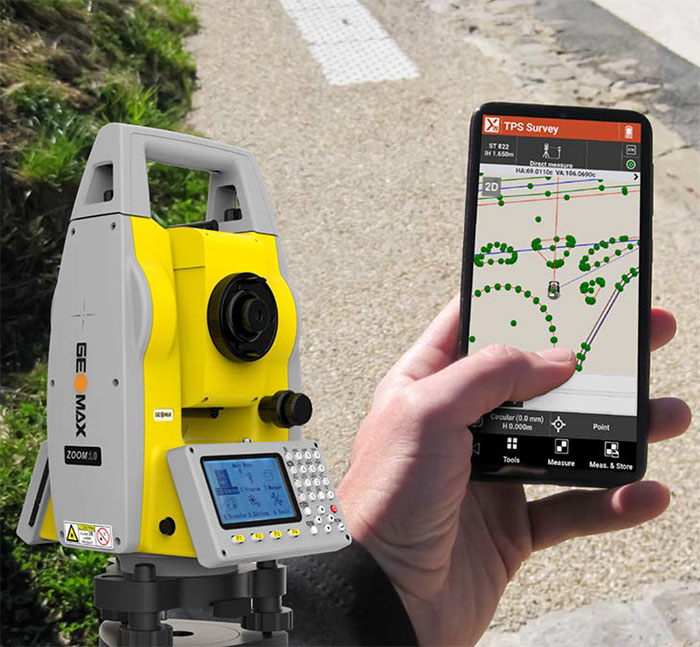
Hexagon Quality Control
The GeoMax software and total station
portfolio have been conceived to fulfill your needs when
working in the most challenging environments. Just like all the
other GeoMax products, the X-PAD Ultimate GO and
the Zoom10 follow the quality control of Hexagon.
Staking out points, lines, drawing cannot be simpler
X-PAD Ultimate GO runs perfectly well on most Android
smartphones. You can do survey and stake out, including the addition of
points, lines, arcs within the graphical view on your phone.
COGO and Reference line
X-PAD Ultimate GO includes several COGO features that help
you determine new points or execute various calculations. The software also
provides the Reference Line procedure, which gives you access to more
information related to the current position with respect to an element chosen
as reference (line, arc, drawing element).
Share and transfer: field and office, always connected
You can open and import any file, even from the cloud.
Thanks to X-PAD Ultimate GO, you can save your data on the most popular
cloud platforms, like Google Drive, Microsoft OneDrive and Dropbox. It is
so easy to get the access to your data from the field or from your office.
Download PDF


